Culture and Heritage
Baja, Baja California, or the Baja California Peninsula?
Baja, Baja California, or Baja California Sur? The names of the peninsula and its surrounding waters carry centuries of history. From ancient Indigenous place names to California, the Gulf of California, and the Sea of Cortés, this article explains how to refer to the region accurately—and what each name reveals about its geography, history, and identity.
Published September 2026
8 minutes
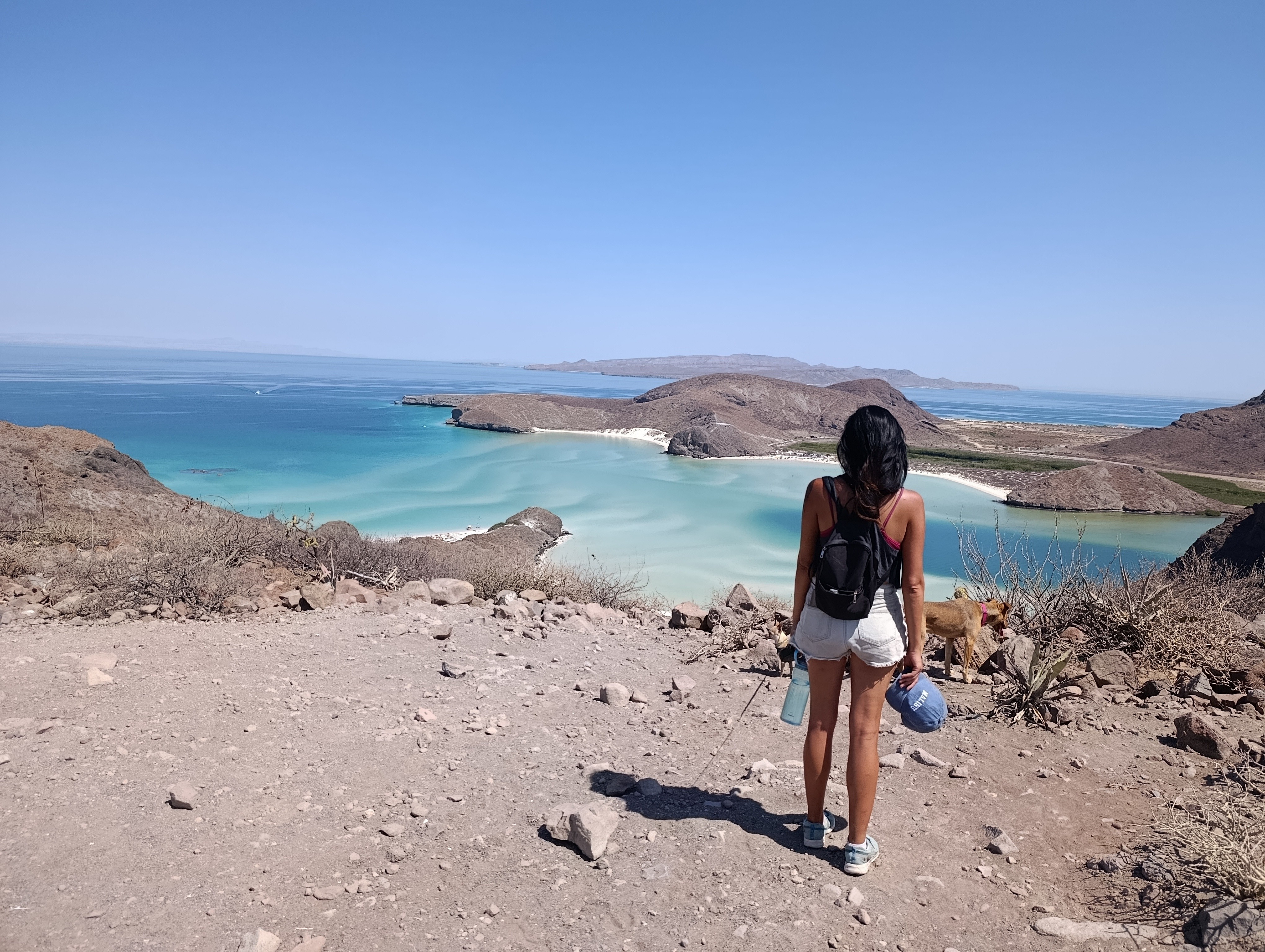
A guide to the names of this region and the waters surrounding it
It is common to hear people say, “I’m going to Baja California,” “I visited Baja,” or “I love Baja,” even when their entire trip took place in La Paz, Loreto, or Los Cabos. These expressions are not necessarily wrong, but they can be imprecise: the Baja California Peninsula and the state of Baja California are not the same thing.
The region’s names carry a complex history. Some originated in Indigenous languages; others emerged from literature, maritime exploration, colonization, and later political divisions. To understand them, we must first distinguish the land from the waters surrounding it.
One peninsula, two states
The Baja California Peninsula is the long strip of land extending from northwestern Mexico between the Pacific Ocean and the Gulf of California. Today, it is divided into two Mexican states:
Baja California, in the north, has Mexicali as its capital and includes Tijuana, Ensenada, Tecate, and the Valle de Guadalupe.
Baja California Sur, in the south, has La Paz as its capital and includes Los Cabos, Loreto, Todos Santos, Mulegé, and several of Mexico’s gray whale sanctuaries.
Therefore, if you travel to La Paz, you are not visiting the state of Baja California. You are in Baja California Sur, while also traveling within the wider Baja California Peninsula.
“Baja” is a widely used colloquial expression—particularly in tourism and among international visitors—for the entire peninsula. It is not the official name of either state, and its meaning can become confusing without further context.
The demonyms are also different: residents of the northern state are called bajacalifornianos, while the people of Baja California Sur are sudcalifornianos.
Gulf of California, Sea of Cortés, and Mar Bermejo
The body of water separating the peninsula from mainland Mexico is officially known as the Gulf of California. It is approximately 1,100 kilometers—or about 680 miles—long and opens into the Pacific Ocean between the southern end of the peninsula and Mexico’s western mainland coast.
The name Sea of Cortés remains common in historical, cultural, and tourism-related contexts. It refers to Hernán Cortés, who sponsored several expeditions to the northwestern reaches of New Spain and personally reached what is now the Bay of La Paz in 1535. However, there is no evidence that Cortés personally named these waters after himself; the term became established later in his honor.
There was no presidential decree in 2023 replacing “Sea of Cortés” with “Gulf of California.” The latter had already been used as the official geographical name for many years. Both names remain recognizable, although Gulf of California is generally preferred in scientific, geographical, and administrative contexts.
Historical documents and maps also use the Spanish name Mar Bermejo, or “Vermilion Sea.” It may refer to the reddish appearance occasionally produced in the northern gulf by sediments carried by the Colorado River.
Before Europeans arrived, these waters were not an unnamed space. The Indigenous peoples living along their shores knew and named bays, islands, channels, beaches, freshwater springs, and fishing grounds, although no single Indigenous name for the entire gulf has been preserved in surviving records.
When the Pacific Ocean was the “South Sea”
The peninsula’s western coast faces the Pacific Ocean. During the earliest Spanish explorations, Europeans called it the South Sea, a name introduced by Vasco Núñez de Balboa after he observed the ocean from the Isthmus of Panama in 1513.
Consequently, when sixteenth-century accounts describe expeditions into the “South Sea,” they are not referring to another body of water. They mean the ocean we now call the Pacific. The modern name spread after Ferdinand Magellan called it the peaceful sea, inspired by the relatively calm conditions he experienced during part of his voyage.
Before it was called California
The peninsula’s history did not begin with the arrival of Europeans. For thousands of years, it was inhabited by hunter-gatherers, fishers, and navigators who adapted to its varied landscapes. Most of the peninsula lay outside the cultural region generally known as Mesoamerica.
We do not know of a single Indigenous name for the entire peninsula. Different peoples named and organized their own territories. Colonial records preserved several place names associated with locations we know today under different names:
Airapí, connected with the bay and region of present-day La Paz;
Conchó, associated with the Loreto area;
Yenecamú, connected with the region around Cabo San Lucas;
Añuití, associated with the area of San José del Cabo;
Aiñiní, connected with the Santiago region.
These correspondences should be treated with care. A name could refer to a settlement, a bay, a freshwater source, or a wider territory, and its meaning did not necessarily match the boundaries of a modern city.
Remembering these names matters because they show that, long before it became California, this land was already inhabited, traveled, understood, and named.
From a fictional island to a real territory
The name California first existed in literature. It appears in Las sergas de Esplandián, a chivalric romance written by Garci Rodríguez de Montalvo and published in the early sixteenth century. In the story, California was a fabulous island near the Indies, inhabited by warrior women and ruled by Queen Calafia.
When the men of Fortún Jiménez reached the peninsula around 1533 or 1534, they believed they had found an island. The presence of pearls and stories about its inhabitants may have encouraged comparisons with Montalvo’s imaginary land. However, no direct account written by Jiménez survives to tell us who first used the name or precisely why.
Hernán Cortés arrived in 1535 and called the bay Santa Cruz—today’s La Paz. He or one of his men may have known the novel and associated this supposed island with California, but no surviving document allows us to identify Cortés conclusively as the person who named it.
The first known documentary use—or one of the earliest clearly recorded uses—of California for the real territory appears in the account of Francisco de Ulloa’s 1539–1540 voyage, written by the pilot Francisco Preciado. Ulloa sailed to the northern end of the gulf, returned along the peninsula’s eastern coast, rounded Cabo San Lucas, and continued northward along the Pacific. His voyage provided the first practical maritime demonstration that the land was connected to the continent.
Despite this evidence, California continued to appear as an island on numerous European maps for centuries. The literary imagination proved remarkably persistent.
The complete story of Fortún Jiménez, Cortés, Ulloa, Queen Calafia, and the supposed island deserves an article of its own. For now, one essential idea is enough: California was the name of an imaginary place before it became the name of a real territory.
From California to Las Californias
During the colonial period, the name California came to encompass a much larger territory than today’s peninsula. As exploration and the mission system expanded northward, Spanish documents increasingly referred to Las Californias—the Californias.
They distinguished between:
Antigua or Baja California—Old or Lower California—corresponding primarily to the peninsula;
Nueva or Alta California—New or Upper California—located farther north and extending across part of what is now the United States.
Following the Mexican–American War of 1846–1848, Mexico ceded Alta California under the Treaty of Guadalupe Hidalgo. In 1850, part of that vast former territory entered the United States as the state of California.
This explains an apparent contradiction: California in the United States retained the name without the word “Alta,” while the Mexican peninsula remained identified as Baja California.
When was the peninsula divided?
The administrative boundary between northern and southern Baja California changed several times during the nineteenth and twentieth centuries. In 1931, the peninsula was formally divided into the Northern Territory and the Southern Territory of Baja California.
The Northern Territory became the state of Baja California in 1952. The south remained under federal administration for more than two further decades. It had a much smaller population, communication and transportation were difficult, and its governor was appointed by the federal government rather than elected locally.
Finally, in 1974, the Southern Territory became the state of Baja California Sur. Since then, the peninsula has consisted of two distinct Mexican states, united by a shared geography, history, and network of ecosystems.
A geography shaped by water
Aridity and the uneven distribution of fresh water have shaped human life on the peninsula since ancient times. This does not mean that the land was incapable of supporting people. Its Indigenous communities developed profound knowledge of freshwater springs, seasonal cycles, plants, terrestrial wildlife, and marine resources.
Limited access to water nevertheless complicated the earliest colonial settlements. Santa Cruz, San Bruno, and other attempts failed for several reasons, including shortages of water and food and their dependence on supplies shipped from the mainland. The first permanent Spanish mission settlement was not established until 1697, when Juan María de Salvatierra founded Nuestra Señora de Loreto Conchó.
The same fundamental question remains relevant today: how much urban and tourism development can the aquifers of an arid peninsula sustain? Understanding its geography and history helps explain why many communities question large developments that could place additional pressure on already limited water resources.
So, what should we call it?
For greater geographical and historical precision:
Baja California Peninsula: the entire Mexican peninsula.
Baja California: the Mexican state in the north.
Baja California Sur: the Mexican state in the south.
Baja: an informal name for the peninsula or one of its regions; its meaning depends on context.
Gulf of California: the official geographical name of the body of water between the peninsula and mainland Mexico.
Sea of Cortés: the historical, cultural, and tourism-related name for the same body of water.
Pacific Ocean: the ocean west of the peninsula, called the “South Sea” in early Spanish accounts.
California: the U.S. state that formed part of historical Alta California.
Las Californias: a historical term encompassing various territories of Baja and Alta California.
Names are never entirely neutral. They preserve the memory of those who inhabited a place, those who imagined it, those who attempted to conquer it, and those who continue to protect it. Naming the peninsula accurately is more than a matter of grammar: it is a way to understand its geography and recognize the many layers of its history.
If you enjoy history, geography, and anthropology, join us in exploring the landscapes of Baja California Sur. At Aquaterra Nómada, we do not simply show you places: we seek to understand them, listen to their stories, and learn why they deserve our care.
SHARE THIS STORY